Street-Level Imagery by Bee Maps is Redefining Mapmaking

It’s an exciting time for geospatial technology, particularly at the street level, where innovation isn’t just about maps—it’s about reshaping how we experience and navigate the world around us. At the forefront of this revolution is Bee Maps powered by Hivemapper, a company driven by crowdsourced mapping, AI-driven spatial intelligence, and an ambitious vision to redefine mapping. Street-level imagery has proven to be the cornerstone of mapping technology, adopted widely by industry giants. Yet, Bee Maps demonstrates that there’s still enormous room for innovation, making it an exciting entry point into the dynamic world of geospatial technology.
Goli Emami, a Stanford-educated AI scientist who joined Hivemapper about seven months ago, embodies this excitement. With a robust background in AI, including roles at prestigious companies like C3AI and internships at Uber’s autonomous driving team, Goli chose Hivemapper to dive deeply into the practical, impactful applications of AI and graph theory on real-world problems.
“I’ve always been passionate about applying theoretical computer science to tangible challenges,” shares Goli. “At Bee Maps, the speed at which we innovate and iterate is incredible. In just seven months, I feel like I’ve gained experience equivalent to five years at a traditional big tech firm.”
Bee Maps operates uniquely through a globally distributed network of drivers who’ve joined the network and are equipped with advanced edge computing devices—far beyond traditional dashcams. These devices capture detailed imagery every eight meters, instantly processing data through highly efficient AI algorithms, currently employing computer vision models, to detect critical street-level objects such as signage, construction zones, and billboards. This data is then validated and utilized to generate highly accurate mapping information, identifying changes to ensure that map data remains consistently updated. Drivers are compensated for capturing this valuable data and may receive additional incentives to focus on specific areas where detailed mapping data is particularly needed.
“Our ability to rapidly iterate and expand our object detection capabilities is fascinating,” explains Goli. “If there’s a client request for specific spatial intelligence—say, identifying construction zones or certain billboards—we can deploy customized AI models within days, gathering data through incentivized crowd participation and quickly turning raw images into actionable insights.”
The company’s advanced ‘AI Trainer Pipeline’ platform incentivizes users through rewards, such as tokens or financial compensation, to label data, dramatically accelerating model training processes. Goli notes that this innovative, human-in-the-loop methodology can transform thousands of raw data points into high-quality labeled data overnight.
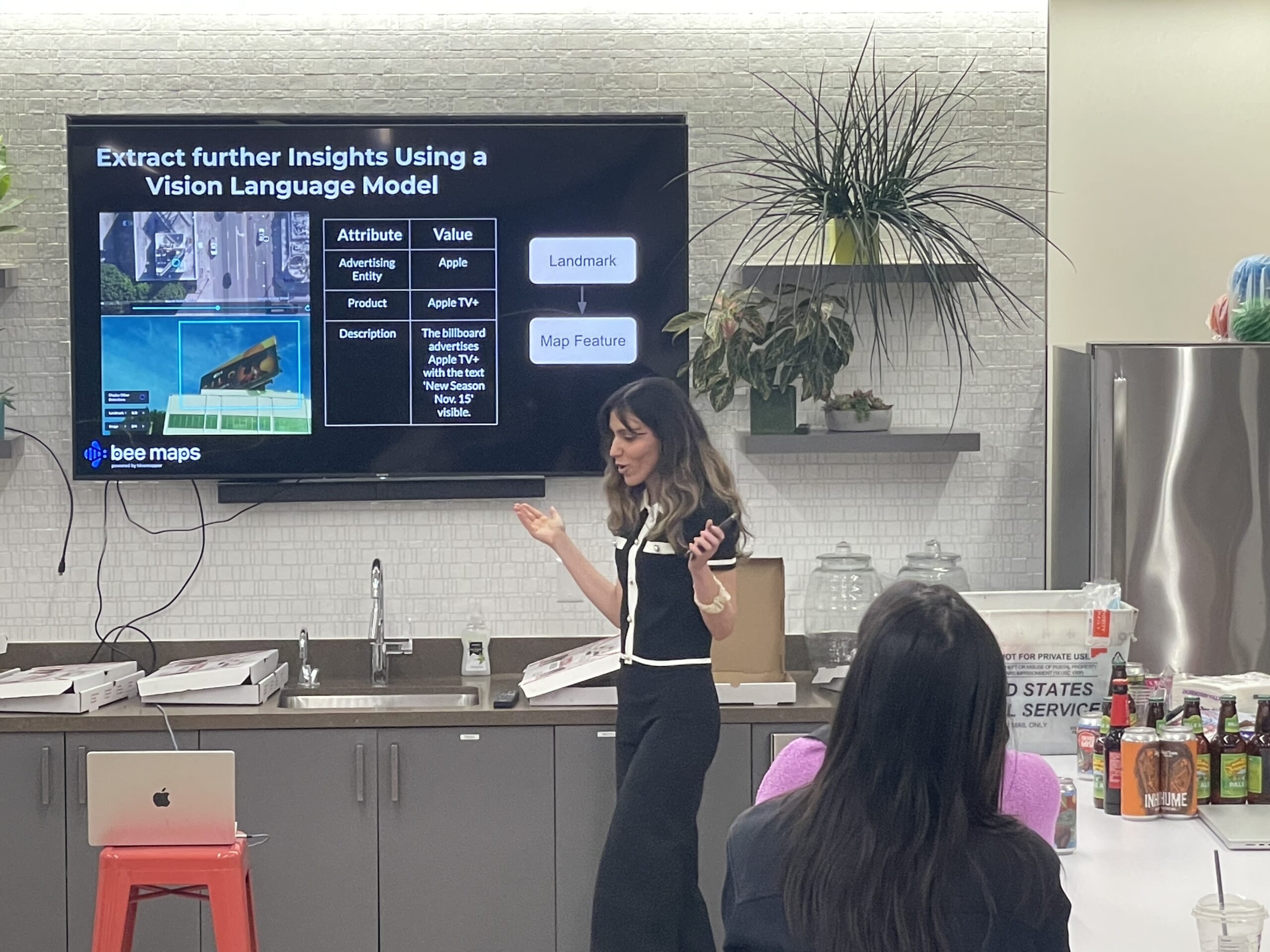
What’s especially thrilling for Goli—and anyone joining the Bee Maps team—is the opportunity to work directly with cutting-edge vision language models (VLMs). These AI tools,, extract sophisticated metadata from imagery, making it possible to interpret complex visual data like gas prices or dynamic billboard content, even where conventional OCR fails.
Goli also emphasizes the strategic aspect of her role, dedicating much of her time to exploring emerging research, experimenting with new model architectures, and pushing the envelope of what’s possible in AI-powered geospatial solutions. “About 70% of my work involves experimentation and staying at the forefront of technology,” she says. “We’re always exploring new models, testing their capabilities, and rapidly integrating successes into our pipeline.”
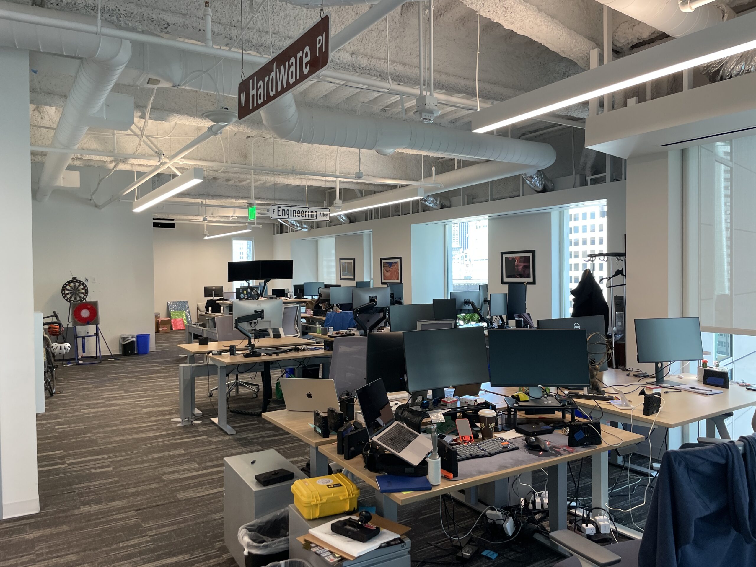
Culturally, Bee Maps stands out too. With a flat organizational structure focused purely on innovation and execution, team members like Goli experience an environment free from corporate politics. “Here, it’s build, build, build—fast and efficient,” she remarks enthusiastically. “The culture was a huge draw for me. Everyone is laser-focused on progress and collaboration.”
Looking ahead, Goli sees enormous potential not just for Bee Maps but for the entire geospatial sector. From embedding AI directly into vehicle systems to creating real-time, dynamic mapping infrastructures powered by crowdsourced data, the future is rich with possibilities. Bee Maps, she believes, is perfectly positioned at this intersection of innovation, technology, and practicality.
For those considering their next career move, Bee Maps powered by Hivemapper offers more than a job—it’s an opportunity to shape the future of mapping technology. As Goli’s experience shows, joining Bee Maps means becoming part of a pioneering team that’s redefining geospatial technology, one street-level insight at a time.
댓글
댓글 쓰기